Our 2011 Utah 1088 Rally Ride
|
First a little background:
Two years ago Tamara and I participated in our first organized endurance motorcycle event. The Utah 1088 . At the time we were no strangers to riding long distances on a motorcycle but the 1088 would be our first competitive event. Although we successfully finished and took third place in the couples division (there were only three couples entered) our overall position was disappointing, to say the least.
The mistake we made was to choose an alternate route rather than riding the rally proper. As a result we ended up riding 1,405 miles and 28,805 points which placed us 42nd overall.
This year was going to be different. No alternate routes, we were there to rally.
The ride down to Salt Lake City was mostly uneventful. We arrived at Rally Central around 1445. That gave us plenty of time to check into the hotel and get cleaned up for the BBQ starting at 1700.
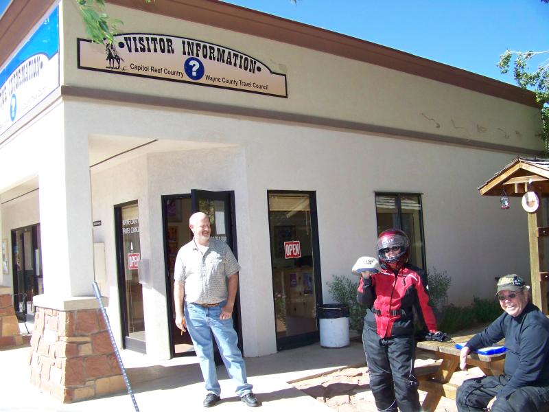
The next day was spent dinking around until it was time to check in for the Rally. During the check in process we had to take a picture of ourselves with our camera in order to make camera/card identification a lot easier if it were somehow to become lost.
Here's ours:
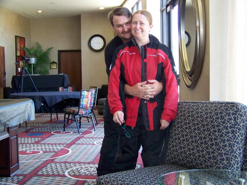
Would you believe we were still as happy looking when we finished?
Part of the check-in process was riding a pre-determined route in order to calculate an error correction for the odometer. I immediately recognized the route. Last time we forgot something back at the hotel when we left for Reno and this route was exactly the route we took to go back and get the stuff.
After the ODO check was done all that was left to do was make sure we were at the rider meeting on time at 1900. During the rider meeting Steve laid out some last minute items (like the requirement of completing a minimum of 1,088 miles to be a finisher), sealed our driver licenses in an envelope, and handed out the bonus listing. Last time the bonus listings for the Leg 1 weren't handed out until the morning of the start and Leg 2 bonii weren't handed out until the checkpoint. That allowed for only 15 minutes of planning before the official start. This time we had the entire rally in our hands the night before...
This was going to be a long night.
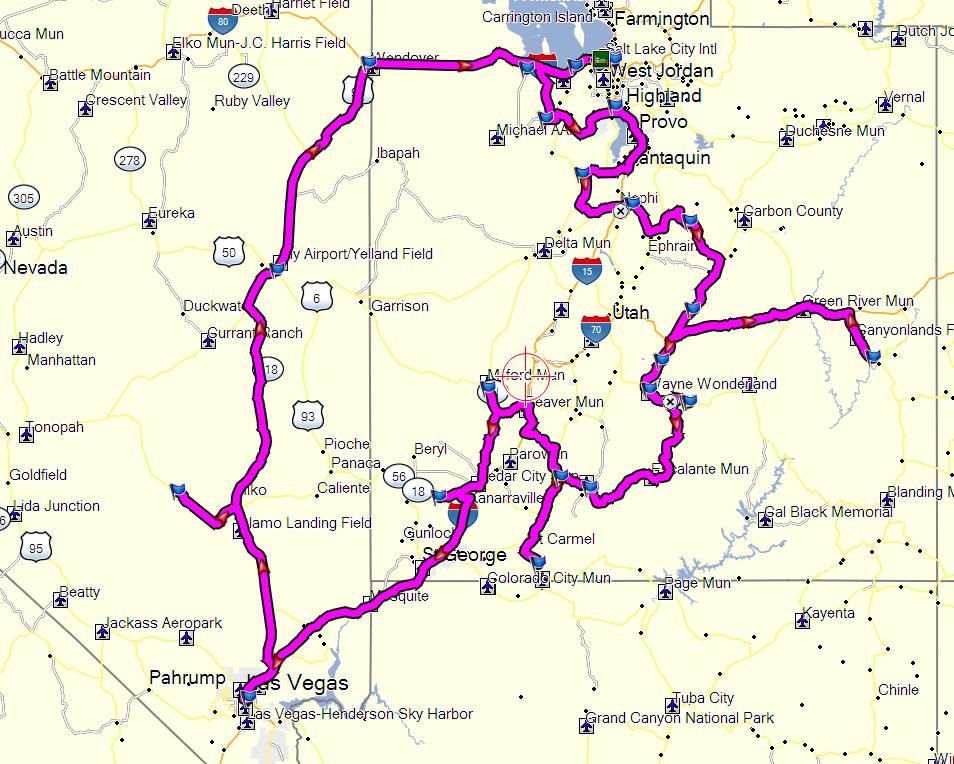
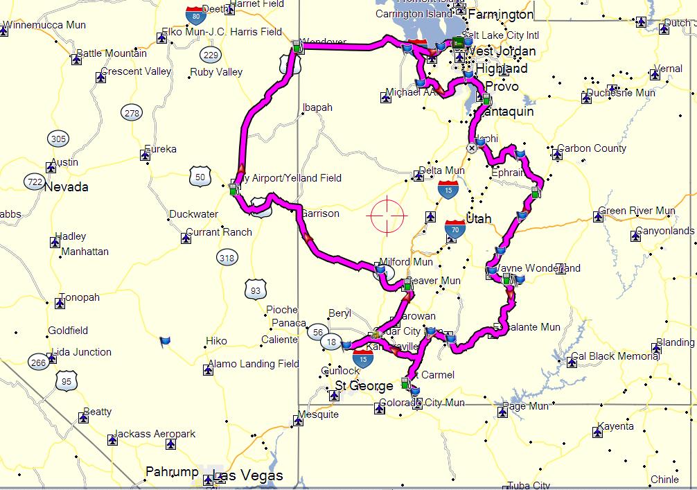
I spent a while (I ain't saying how long) entering the bonii into MapSource. Getting near the end, and before saving my work, MapSource apparently decided that I was having too much fun. It crashed and took with it everything I had done to that point. After starting over (and saving the file after every entry) I finally had all the bonus locations entered and plotted the most efficient route I could figure. It ended up being 1868 miles with a little more than 29 hours of travel time (not including stops for fuel, pictures, forced death marches through the desert wearing riding gear, etc.).
Well, that wasn't going to work...
Paring it down a little by trimming off what I saw as "sucker bonuses" I was able to work it down to a route of a little under 1200 miles and around 19½ hours on the bike. It also left a couple of "outs" in case we got too far behind and had to get back to SLC before the 0700 finish time.
After making a couple hand-written notes to help us remember what we needed to find at each location without dragging out the rally paperwork underway, we were finally ready.
Making its comeback in this year's rally was the opportunity to win a handgun. Up for grabs was a Walther PPK .380. All that was required to win the handgun was to score the best score in a shooting competition. Three shots at 15 yards. This was our first bonus stop. Needless to say, we didn't win. We did however bag our first bonus and were on the road well ahead of the time I'd counted on getting out of there.
The next two bonii were in downtown SLC. One was a new bike shop that was handing out business cards and the other was to find a date on a monument to two police officers that were killed in the line of duty. Once I got squared away on which was was East and which way was West, finding the monument was a piece of cake. (Note to self... Slow down, relax. Think things out. The sun rises in the East...)
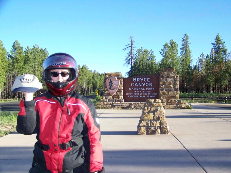
Traffic in SLC at 0745 on a Sunday morning was surprising light. We were in and out in no time and headed west to pick up another bonus on the shore of the lake:
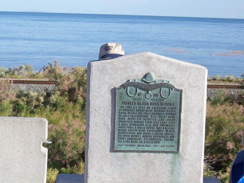
You might notice the hat sitting there... That hat had to be in every picture we took or the picture would be useless. (Hi, Tom!)
Next on the list was to drive down a highway and find the name of a geological formation off the side of the road. From there we needed to find our way to Rush Valley and determine when it was established. At the rock formation there were a few other bikes already there when we arrived. We all departed about the same time and it was pretty obvious they were also headed to Rush Valley but they were going a different way. "Heh" I thought... We're gonna get there first. As it turns out, if the road I chose didn't have 47 different applications of asphalt repairs and a cattle guard every 32½ feet, we would have arrived long before them. We actually got there around the same time.
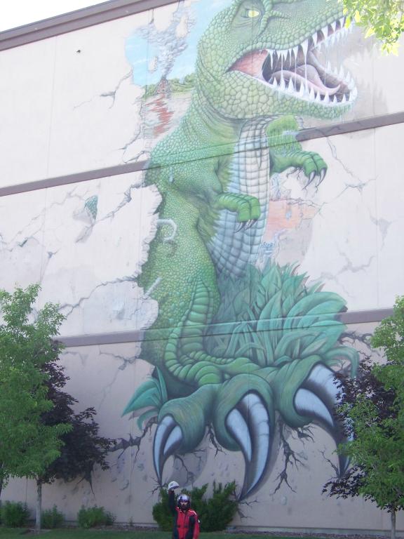
From Rush Valley it was off to Lehi to find the Museum of Ancient Life and get a picture of the dinosaur painted on the north side of the building:
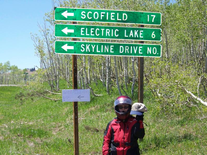
Next on the list was making it to the first of two checkpoints. The first checkpoint was open from 1100-1230. We rolled in at 1140, got our paperwork signed by the Rally Master, then headed off for the next bonus. Here we were required to find the name of a specific Scenic Byway positioned between a couple of mile markers on Utah 132. After that we had to find a sign, any sign, with the words, "Electric Lake" on it...
By this point we'd been riding a little slow, the engine was getting warm, the elevation was nearly 9800' and the bike was not enjoying the corn squeezin's in the fuel. It took a bit before it wanted to start again. Amazingly enough, though, it was getting *great* MPG the entire trip. The lowest we saw the entire weekend was 42 mpg with the highest being right at 50 (between Idaho Falls and Big Sky).
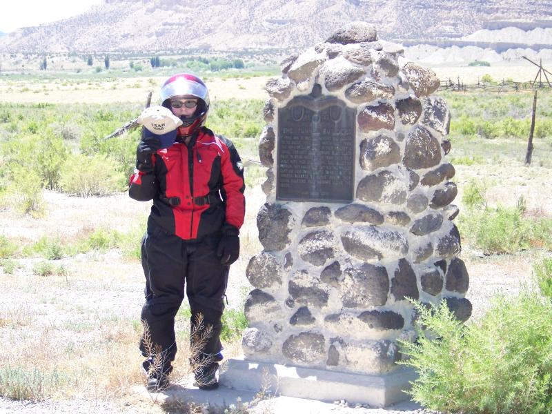
After snagging the Electric Lake sign we needed to find another sign proclaiming the elevation of the summit on Utah 10. After that we searched for another monument that told the story of "The Tunnel Builders"
Next on the list was another monument with "something unique" on top of the monument its self. (No picture, just an answer)
With checkpoint two looking in the distance, my speed/distance calculations showed me we were actually going to be getting there too early. The checkpoint didn't open until 1600 but as we went by at 1553, there were already bikes parked and guys milling around. We weren't going to waste time just standing around so we blew on by and picked up a couple more bonii.
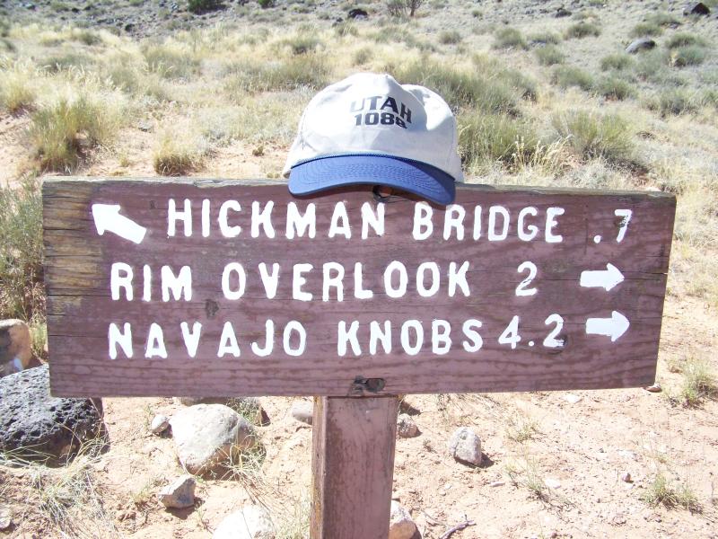
First was counting the faces in a photograph on an information display for the Frutia School in Capitol Reef National Park. Still not sure if we counted the faces correctly or not. I know we didn't get all the points we claimed in the end and this was the only one that left room for error. Everything else was a straight forward answer but this one seems to be a perennial favorite for Steve. According to the write-up for the bonus, there seems to be some difficulty in getting the correct count. We both counted several times and kept coming up with the same number so we went with it...
After leaving the school it was time for the forced Death March. By this time it was starting to get pretty hot. I found the last remnants of shade in the parking lot to put the bike. Took off my jacket, grabbed the camera and headed off for the trail. I got about 75 feet away when Tamara hollered out, "You got the hat?"
Now with the camera *and* the hat, I set off once again. I suppose if I was actually out for a hike, wearing the right clothing and shoes, and carrying 15 gallons of water it wouldn't have been so bad. I just don't like the heat. I did, however, make it to the sign and bagged another 2,698 points:
Returning to the checkpoint at 1652 it just so "happened" to coincide with our next fuel stop. We got the paperwork signed, took the first of two pictures needed to claim the next bonus...
...then tried to get some fuel. "Tried" being the key word. Apparently after only two gallons dispensed, the station ran out of fuel. We had to go to a different station to finish fueling. That might not sound like much of a big deal, but the fuel filler is buried under the tank bag. Each time we stop, we both have to get off, the tank bag has to be removed, fuel dispensed then the whole operation repeated in reverse. We've got the routine down to a science and even throwing in a potty break for my passenger we can usually complete a fuel stop in less than five minutes. Yet now we're have to do it all over again. Between the checkpoint and getting fuel in two different places, this stop ended up eating away 30 minutes of our time. As you'll see later, 30 minutes can mean *ALL* the difference in the world in these events.
The bonus I mentioned earlier where we were taking the first of two pictures needed to claim the bonus was to ride Utah 12. This highway is reported to be listed as one the the Top 10 Motorcycle Highways in the country and Steve didn't want us worrying about looking for stuff along the way. I have to admit, this was a nice road. If they could get rid of the tar snakes and the cattle all over the public ground clogging up the highway, it would be a *GREAT* road. We made it to the other end with little incident and snagged the second picture to claim another 4,141 points:
This would be the last picture we took for bonus points. There was one more location on our planned route that would require a picture but in the interest of time and staying married, we skipped it. From here on out the bonus locations we visited required answering a question or securing a specific object.
The next stop was at the Red Canyon Visitor Center to get the name of a trail listed on the trail marker sign. From there we headed down to the Moqui Caves to learn who was buried out front for another whopping 4,126 points.
After leaving the caves it was time for fuel for the bike and another potty break for my passenger so I had time to peruse the rest of our planned route. My thinking was that there was no reason to go back north any further than necessary on these dark two-lane highways (55-65 mph speed limits) before cutting over to I-15 where the speed limit was 80 mph. My plan was to use Highway 9 to get from US-89 to I-15 so while I was left alone with the bike for a few minutes I took a closer look. Probably a good thing I did. Upon further inspection on the GPS I saw a segment of Highway 9 that looked like this:
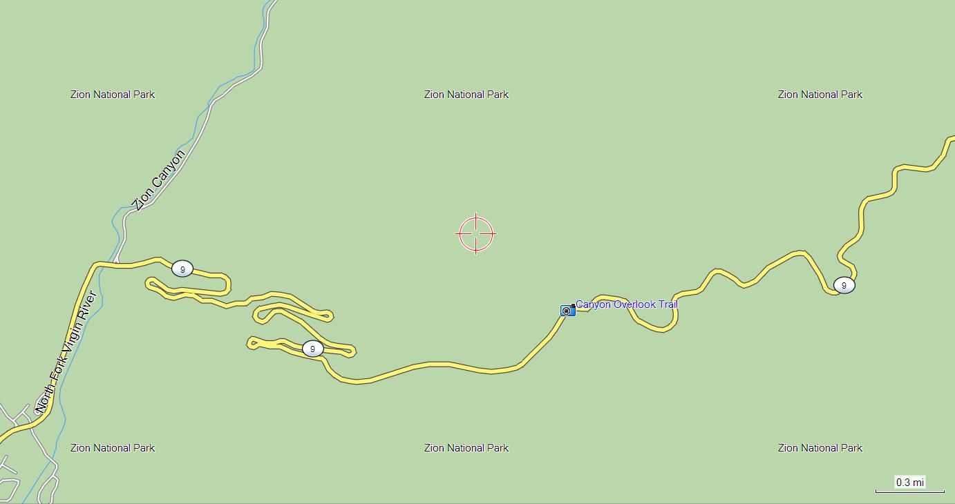
Normally I would salivate profusely at the thought of riding a road like this, but the sun had just gone down... there are deer and elk everywhere... and we were still on the clock. We had less than 10 hours to get back to Rally Central and several more stops planned along the way. This was not the time to be enjoying a road such as this.
We ended up going back up US 89 and cutting across to I-15 on Utah 14 into Cedar City. Using an SUV with HID headlights as a deer catcher we made pretty good time across the mountains but now it was time for a break. Our next planned fuel stop was in Beaver, UT. We needed to make sure we were topped off because of the dire warnings we received about lack of fuel going on into Ely, NV (P.S. There are a couple options for 24 hour fuel in Milford). Other than bonus locations and fuel stops this would be the only "rest" break we took the entire ride. We were actually shut down for 40 whole minutes!!
After leaving Beaver we headed for Milford, NV to figure out when it was established. Note: The deputy on duty that night, while being very nice and accommodating, was not very familiar with the town he was patrolling. The reality of the highway into town did not agree with what was being displayed on the GPS so we were having trouble finding the marker at the edge of town. After consulting with the deputy and riding back and forth past his hiding spot a few times we finally located the sign and scooted on toward Ely.
This was a *BIG* bonus. All we needed to do was get an computerized receipt with the location, date, and time from Ely, NV. This receipt *had* to have a time stamp after 1900 (Pacific). That wasn't a problem... This was a planned fuel stop anyway and we didn't get there until 0300 (0200) anyway so that bagged us another 9,936 easy points.
We were on the home stretch now... All we needed to do was get to Wendover, NV to get a $1 casino chip and a fuel receipt dated after midnight. Again, that was going to be our next fuel stop anyway so between the two we snagged another 2,400 points.
About this time things were starting to get pretty tight. It was a little after 0500. The GPS was saying we were going to be getting back to Rally Central at 0652 and we had until 0700 to get there. Although much of the trip was across the Bonneville Salt Flats, I still had to be careful. Since we don't carry any kind of speed detection detection devices, all I had to use for evasion was the old MK1 MOD1 Eyeball Unit. Adding even more difficulty to the mix was the sun that was peeking over the horizon and we were headed right into it... According to the GPS, we averaged exactly 74 MPH between Wendover and Rally Central. We pulled into the parking lot at 0642 (remember earlier when I told you that 30 minutes can make all the difference in the world?) and our ride was over. The scoring had only just begun. we had one hour from the time we pulled in until we had to have all of our paperwork turned in and scored.
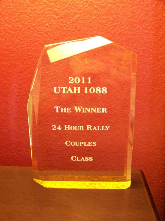
I don't remember the exact number of points we scored. We turned in 73,137 and I think we ended up with 72,xxx. We won the two-up category in the 24 hour event and in the end we were able to improve quite dramatically on our overall position.
Whereas last time we were 42nd overall, this time we were either 3rd or 4th from all the 24hr event riders. I didn't manage to snag a copy of the score sheet so we'll have to wait until Steve publishes them.
There is some talk of this being the last Utah 1088. I hope not. We're just getting started.
|